Risk Assessment North Coast Java
-
Coastal resilience
-
Coastal wetland conservation
Flood risk is challenging food and water security and economic development for millions of people. A new study by Deltares assesses coastal flood risk for North Java. In this study, an area is considered under risk if intensity and probability of flooding are high and if many people or assets are potentially affected by the flooding. The report was developed as part of the Building with Nature Indonesia project managed by Wetlands International to support mainstreaming of the Building with Nature approach in Central Java and to support mainstreaming of the Building with Nature approach in Central Java and inform measures to mitigate and adapt to land subsidence..
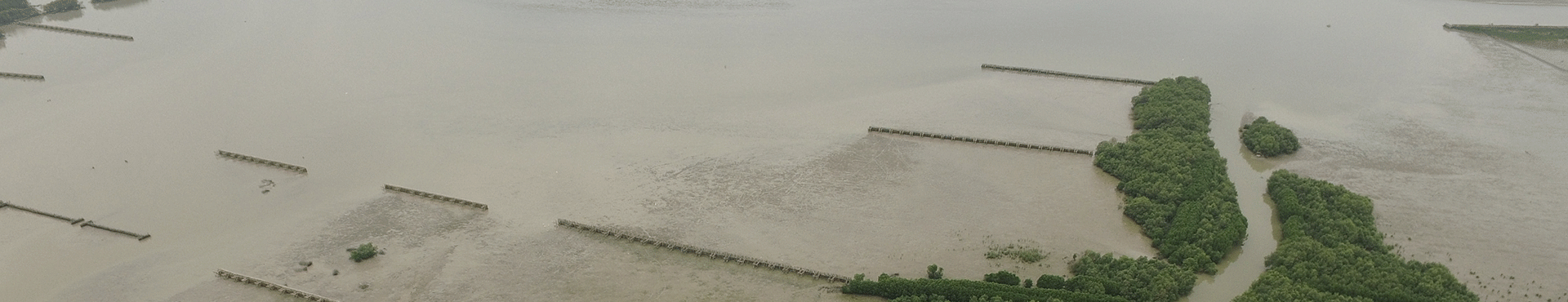
Hazards included in the study are storm surge and relative sea level rise, which can become more extreme as a result of climate change and man-made influences that cause land subsidence and ecosystem deterioration. The study pinpoints high risk areas with the aim to inform strategic planning for coastal zone management. The flat and low lying coastal plain of Northern Java is very susceptible to subsidence and sea level rise and 2.5 million people are located in hotspots that with 0.5 to 1 meter subsidence can potentially flood with average storm surges. This is equivalent to 20% of the population of North Java.
The study also presents possibilities for mitigation of flood risk and states that the conservation of mangroves in rural areas should be top priority to maintain coastal integrity. In the long-run, limiting ground water extraction, bringing rivers back into the floodplain and using Building with Nature measures including protecting mangroves seem the most cost-effective strategies for the North Coast of Java. Only by doing this, loss of land and flooding can be mitigated along Javanese coastlines.